...
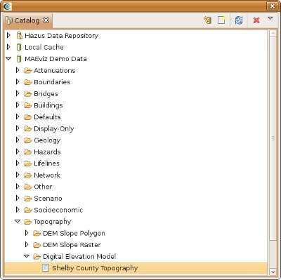
First, we will add elevation data to the scenario. In the Catalog view (the lower-left view of your workbench is arranged in the default setting, as shown in the figure below), expand the MAEviz Demo Data item, then Topography, and finally Digital Elevation Model. Click and drag the Shelby County Topography item into the Visualization View.
At this point, an elevation map should have been added to the Visualization View. We will also add building information to the Scenario. Under the Catalog View, still under the MAEviz Demo Data item, expand Buildings, then Building Inventory v5.0, then Shelby County No SF Buildings v5. Drag the dataset for Shelby County No SF Buildings v5, which excludes single family homes, into the Visualization View as well. Alternatively, you can right-click the item and select Load Dataset.