...
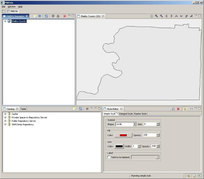
At this point, your scenario has been created. You will see your scenario listed in the Scenario View and a blank outline of Shelby County has appeared in the Visualization View. See figure below.
Next, we will learn how to add data to our scenario, and how to manipulate the Visualization View.
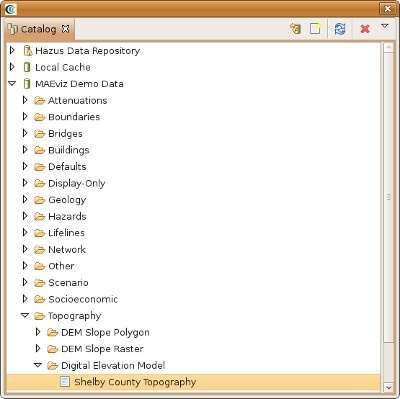
First, we will add elevation data to the scenario. In the Catalog view (the lower-left view of your workbench is arranged in the default setting, as shown in the figure below), expand the MAEviz Demo Data item, then Topography, Digital Elevation Model. Click and drag the Shelby County Topography item into the Visualization View.